


Car park usage data
Drone data collection and analysis showing exactly how your car park is used, space by space and hour by hour.
Available Files: Occupancy Data, Heat Maps & Reports
10 min
Capture Intervals
Every
Space Analysed
Heat
Maps & Reports
0
Cameras to Install
Car Park Data Collection & Analysis
For supermarkets, shopping centres, retail parks and other sites, the car park is the first and last part of the customer experience. Knowing how it’s really used helps you manage it better.
Drone Site Surveys captures aerial images of your car park at regular intervals, then analyses them to show how every space is used through the day. You’ll see occupancy rates, busy times and length of stay, all without installing any equipment.
The results can help you improve customer experience, make better use of underused areas and support planning applications.
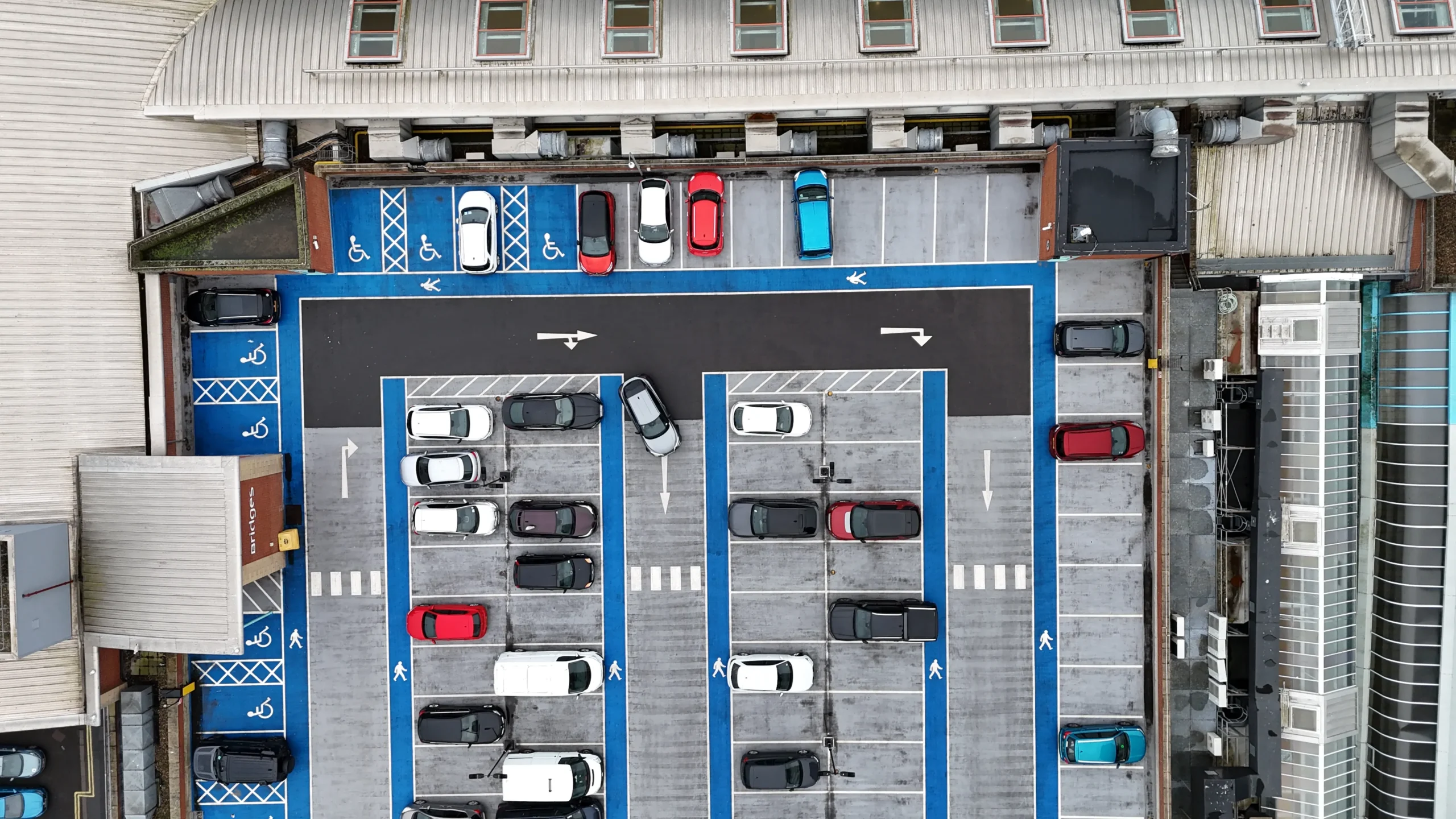
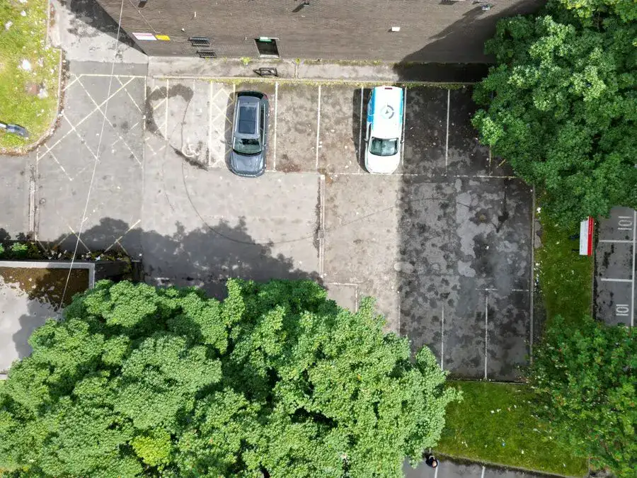
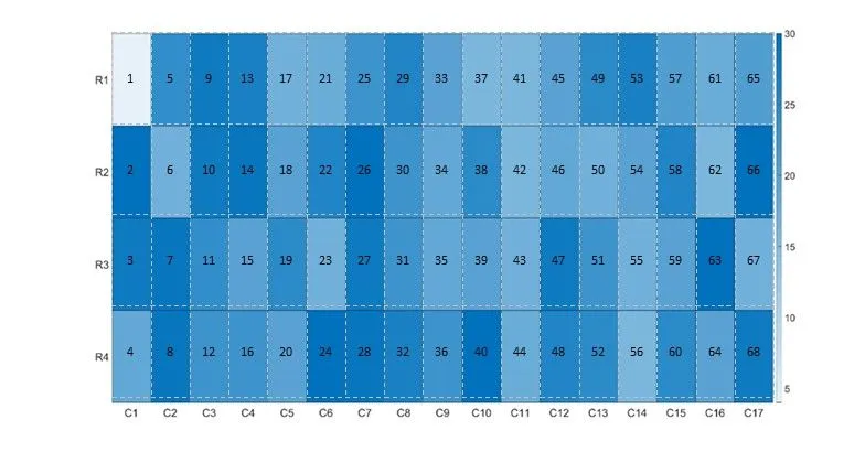
Example Image Quality
Click each image to view example image quality
What Your Car Park Survey Can Include
Every survey is tailored to the questions you need answering, from peak occupancy to bay-type utilisation.
| Deliverable | What it is | Included |
|---|---|---|
| Timed aerial imagery | Images of the whole car park captured at set intervals, as often as every 10 minutes. | Standard |
| Space-by-space occupancy | How often each individual space is used across the survey period. | Standard |
| Occupancy heat maps | Visual maps showing the busiest and quietest areas. | Standard |
| Busy times | Peak and quiet periods throughout opening hours. | Standard |
| Length of stay | Longest, shortest and average stays. | Optional |
| Bay-type utilisation | Use of parent and child, EV charging and disabled bays. | Optional |
| Planning support report | A clear summary of findings to support a planning application. | Optional |
The number of flights and the capture interval depend on the size of the car park and the questions you need answering.
At a Glance
Capture
Timed aerial images
Equipment on site
None installed
Pilot network
Nationwide
Heat maps
Included
Scaffold needed
None
Coverage
Mainland UK
Get a Quote
Send us an address. We will come back the same working day with a price and a scope.
Why Clients Choose Drone Car Park Surveys
Understanding how your car park is used helps you make better decisions. Clients benefit from:
Knowing the condition of your whole portfolio lets you mitigate risk, prioritise spending and act on real evidence rather than assumptions.
The result?
Clear evidence of how your car park is really used, ready to improve operations or support a planning application.
__ Heat maps
See occupancy at a glance
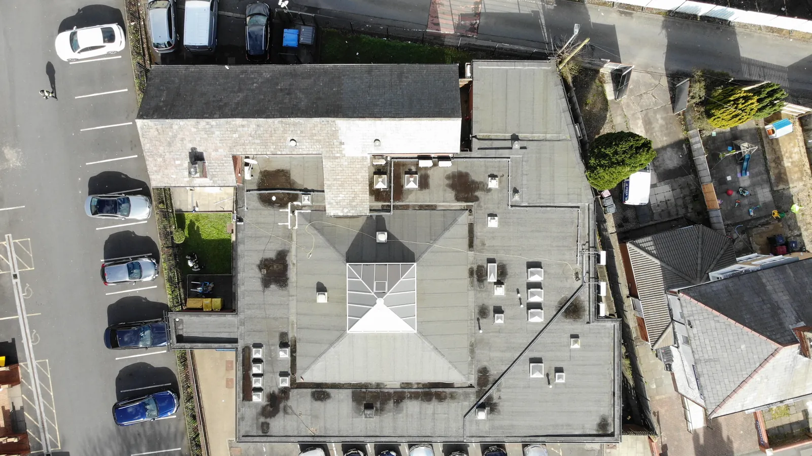
By analysing the imagery captured by our drones, we can work out the occupancy of every individual space and present it as clear heat maps.
The data shows how many times each space is used over the survey period, which areas are busiest and which are underused, so you can see where changes will make the biggest difference.
Every space, every hour, in one clear picture.
CAA
CAA Operational Authorisation 11363
Fully insured, with £10m public liability and specialist UAV cover
__ Why drones
Why use drones for car park data?
Manual counts and fixed cameras only see part of the picture. A drone captures the whole car park in one frame, repeatedly, giving a complete and consistent data set.
- Whole car park in view. Every space captured in every image.
- Nothing to install. No cameras, sensors or counters on site.
- Repeatable. Images taken from the same position every time for reliable data.
- Flexible timing. Survey the days and hours that matter to you.
- Clear outputs. Heat maps and reports that are easy to act on.
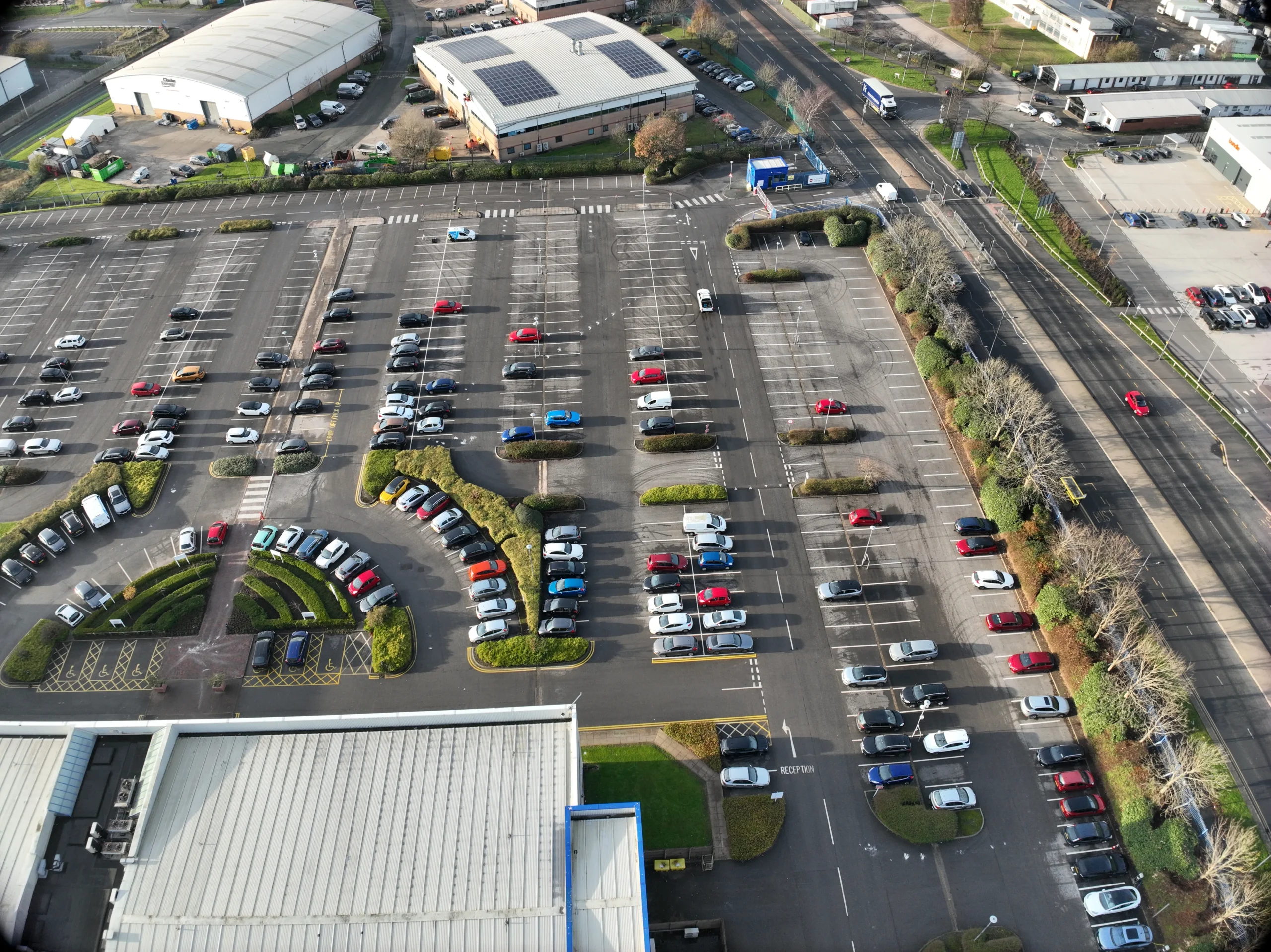
Every image taken from the same position, height and angle.
Who we work with
Car park surveys for retail, commercial and public sites
We work with retailers, landlords, car park operators, planning consultants and public bodies who need reliable evidence of how parking is used.
Our service is suitable for
- ›Supermarkets
- ›Shopping centres
- ›Retail parks
- ›Leisure and entertainment venues
- ›Hospitals and healthcare sites
- ›Universities and colleges
- ›Business parks and offices
- ›Transport hubs and park and ride
- ›Hotels
- ›Local authority car parks
For multi-site operators, we can survey several car parks the same way, so you can compare usage across your estate.
__ Why choose us
Why choose Drone Site Surveys?
Drone Site Surveys specialises in professional survey and inspection data capture rather than general aerial photography.
Our pilots work specifically across commercial and domestic properties, as well as building, construction and land surveying environments. With experience in roof and façade inspections, they understand how to capture clear, relevant imagery that supports practical condition assessment, defect identification and informed decision-making.
Clients choose Drone Site Surveys for our specialist experience, professional standards and independent approach:






__ How it works
Our car park survey process
From first enquiry to secure delivery, every survey follows the same six steps, so you always know what happens next and when.
Tell us about the property
Tell us about the car park, the questions you need answering and the days and times you want to cover. We’ll recommend a capture plan.
Planning and quote
We carry out a desktop assessment of the property and the surrounding airspace, check the survey against current UK drone regulations, and prepare your quote. You receive it by email with no obligation, along with the airspace map for your site and an example delivery so you can see exactly what you’ll be getting.
Booking your date
Once you’re happy with the quote we add your job to the schedule and start monitoring the Met Office forecast. In the meantime we prepare the pre-flight paperwork, including our risk assessment and method statement (RAMS), which we can send over for your records. As soon as we have a clear weather window and pilot availability, we confirm your attendance date. You don’t normally need to be on site.
The survey
Our CAA approved pilots capture images at set intervals, from exactly the same position, height and angle each time, so the data is consistent.
Processing
The images are analysed space by space to calculate occupancy, length of stay and busy periods, then turned into heat maps and a report.
Delivery
We email you a link to our secure online portal, where your imagery, reports and any other agreed outputs are ready to view, download and share with your team or contractors. Alongside the deliverables you’ll find a folder containing the pre-flight paperwork, a copy of the drone airspace map for your site and any other relevant documents, so everything from the survey is in one place.
__ Request a Quote
Request a car park survey quote
Whether you need one busy Saturday or a week of data across several sites, we can tailor the survey to your questions.
Send us the address and a brief description of what you need, and we will come back with clear pricing and deliverable options.
Prefer to Speak to Us?
If you’d rather speak to one of the team, that’s no problem. Simply call the number below and one of our team will be more than happy to help.
Get a Quote
__ In The Know
Frequently Asked
Questions
Answers to the questions we are asked most often about car park usage surveys. If yours is not covered here, give us a call.
What data can a drone car park survey provide?
Space-by-space occupancy, busy and quiet times, length of stay and use of specific bays such as parent and child, EV charging and disabled spaces.
How often are images taken?
Depending on the data needed, as often as every 10 minutes. Every image is taken from the same position, height and angle so the results are consistent.
How is the data analysed?
We analyse the imagery space by space to work out occupancy over the survey period, then present the results as heat maps and a clear report.
Can the data support a planning application?
Yes. Evidence of underused parking can support applications to redevelop or change the use of part of a car park.
Do you need to install any equipment?
No. Everything is captured from the air, so there are no cameras or sensors to fit or remove.
Do you record number plates or people?
The analysis focuses on whether each space is occupied. Talk to us about your data protection requirements and we’ll agree the approach before the survey.