


Disability access surveys
Visual accessibility audits combining aerial imagery and 3D scans, showing how visitors with a disability can reach and use your building.
Available Files: Aerial Imagery, 3D Tours & Access Reports
3D
Interactive Tours
Door
To Door Coverage
Part M
Guidance Referenced
360°
Panoramas
Visual Disability Access Surveys
A disability access survey, also known as an accessibility audit, looks at how a person with a disability or impairment can reach, enter and use your building.
Drone Site Surveys combines aerial overviews, 3D reality scans and measuring tools to record the approach routes, parking and drop-off points, entrances, lifts and stairs, and toilet facilities, with reference to Approved Document M and the Equality Act 2010.
The result can also be shared with your visitors, so people can plan their visit in advance and see exactly what to expect.
Example Image Quality
Click each image to view example image quality
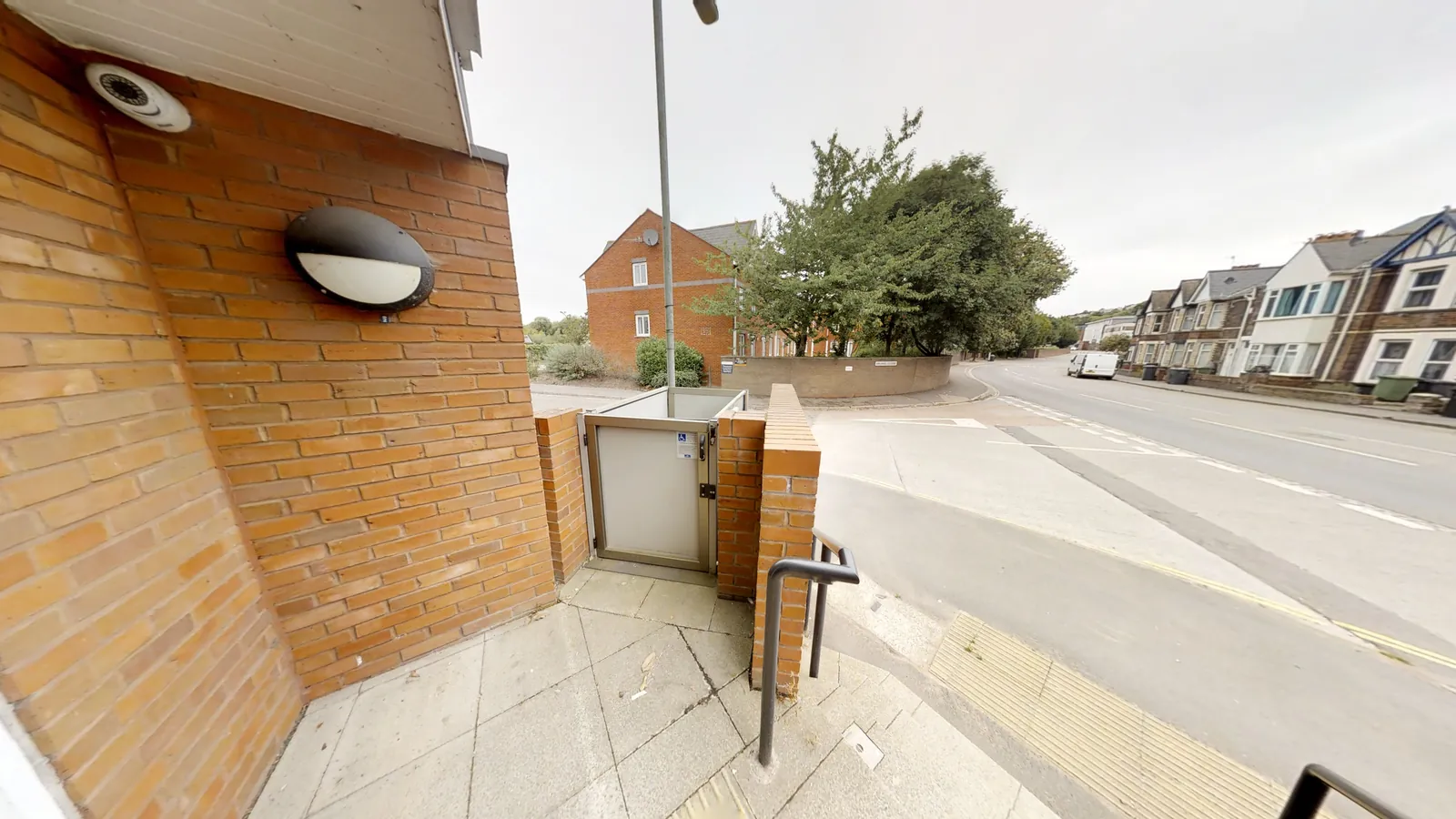
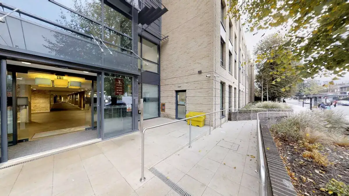
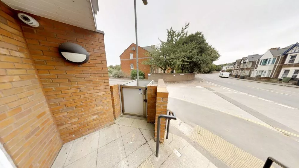
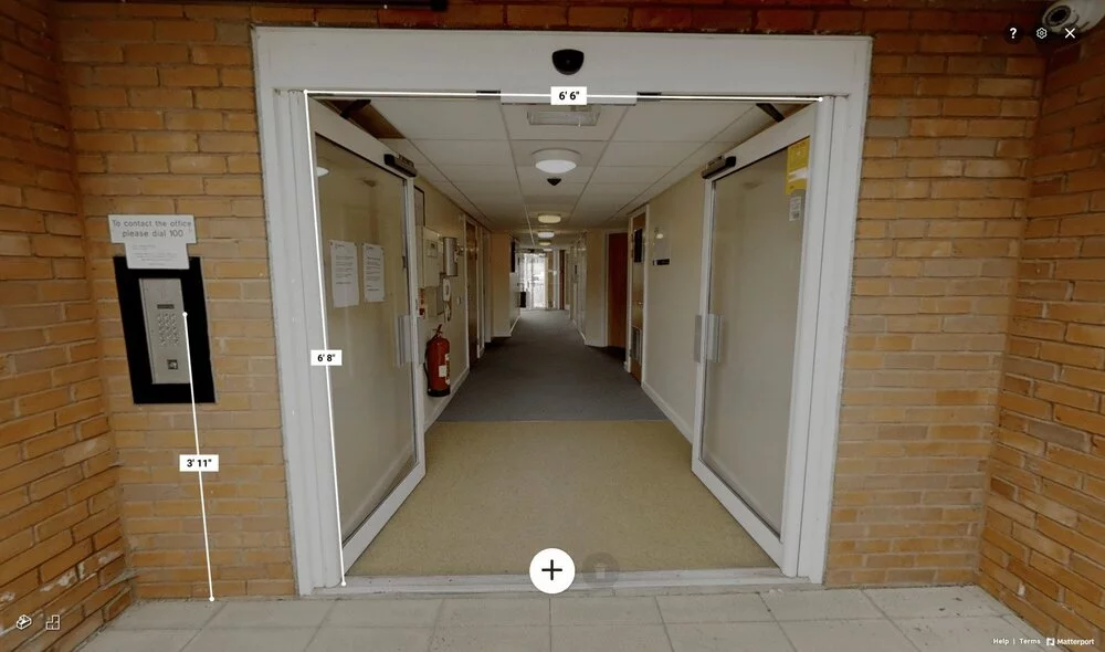
What Your Access Survey Can Include
Choose a physical survey for your own consultants, or a full visual access survey ready to share with visitors.
| Deliverable | What it is | Included |
|---|---|---|
| Aerial overview | Drone imagery of the approach routes, parking and drop-off points. | Standard |
| Entrances and routes | Imagery and measurements of entrances, exits and circulation routes. | Standard |
| Facilities | Lifts, stairs, reception areas and toilet facilities recorded. | Standard |
| Access features highlighted | Level access, door widths, hearing loops, handrails and signage. | Standard |
| 3D interactive tour | A measurable 3D walkthrough from car park to toilets. | Optional |
| 360° panoramas and video | Panoramic images and video for your website and social media. | Optional |
| Website integration | We can build a web page and add it to your website for you. | Optional |
We can also carry out the physical survey only, with no recommendations, for surveying practices and access consultants.
At a Glance
Capture
Aerial + 3D scan
Access required
Building access
Pilot network
Nationwide
3D tour
Optional
Scaffold needed
None
Coverage
Mainland UK
Get a Quote
Send us an address. We will come back the same working day with a price and a scope.
Why Clients Choose a Visual Access Survey
A visual access survey helps you understand your building and welcome more visitors. Clients benefit from:
Knowing the condition of your whole portfolio lets you mitigate risk, prioritise spending and act on real evidence rather than assumptions.
The result?
A clear, visual record of how accessible your building is, plus content that helps every visitor plan ahead.
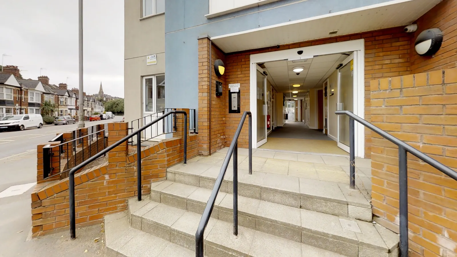
__ Visual access tours
Help visitors plan ahead
Our visual surveys combine aerial imagery with interactive 3D scans, so visitors can follow the route from the car park to the entrance, reception and toilets before they arrive. There’s nothing virtual about it: every image shows the real building.
We highlight helpful features such as level access, door widths, hearing loops, handrails, contrast markings on glass doors and large-print signage.
Every step of the journey, shown as it really is.
CAA
CAA Operational Authorisation 11363
Fully insured, with £10m public liability and specialist UAV cover
__ Why drones
Why use drones for access surveys?
An aerial view shows the whole journey to your building in context: parking, drop-off points, paths, slopes and entrances. Combined with 3D scans inside, it gives the most complete picture of access.
- The whole approach. Parking, paths and entrances seen in context from above.
- Real, not virtual. Every image shows the building as it really is.
- Measurable. 3D scans with built-in measuring for widths and distances.
- Shareable. Content ready for your website and social media.
- Flexible. A physical survey only, or a full visual survey for visitors.
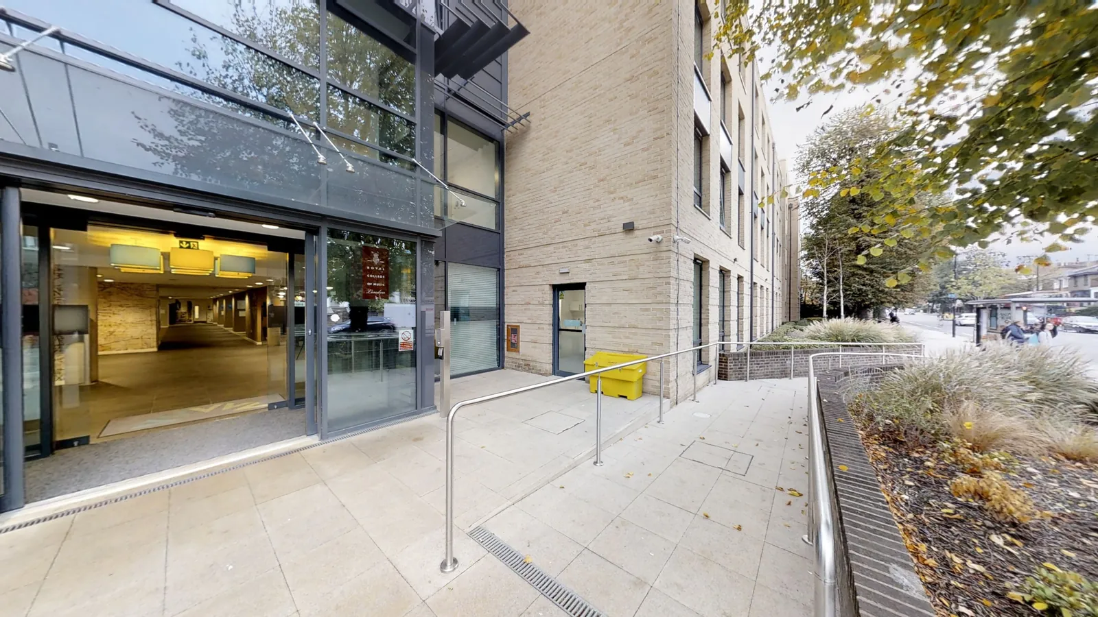
Every step of the journey, from car park to entrance.
Who we work with
Access surveys for businesses, public buildings and consultants
We work with businesses, public bodies, venues and access consultants who want to understand and improve how accessible their buildings are.
Our service is suitable for
- ›Retail and shopping centres
- ›Hotels and hospitality
- ›Leisure centres and venues
- ›Offices and business parks
- ›Local authority and public buildings
- ›Schools, colleges and universities
- ›Healthcare and GP practices
- ›Museums and visitor attractions
- ›Places of worship
- ›Access consultants and surveyors
For organisations with several buildings, we can survey each site the same way so visitors get consistent information wherever they go.
__ Why choose us
Why choose Drone Site Surveys?
Drone Site Surveys specialises in professional survey and inspection data capture rather than general aerial photography.
Our pilots work specifically across commercial and domestic properties, as well as building, construction and land surveying environments. With experience in roof and façade inspections, they understand how to capture clear, relevant imagery that supports practical condition assessment, defect identification and informed decision-making.
Clients choose Drone Site Surveys for our specialist experience, professional standards and independent approach:





__ How it works
Our access survey process
From first enquiry to secure delivery, every survey follows the same six steps, so you always know what happens next and when.
Tell us about the property
Tell us about the building and whether you need a physical survey only or a full visual survey to share with visitors. We’ll recommend the right option.
Planning and quote
We carry out a desktop assessment of the property and the surrounding airspace, check the survey against current UK drone regulations, and prepare your quote. You receive it by email with no obligation, along with the airspace map for your site and an example delivery so you can see exactly what you’ll be getting.
Booking your date
Once you’re happy with the quote we add your job to the schedule and start monitoring the Met Office forecast. In the meantime we prepare the pre-flight paperwork, including our risk assessment and method statement (RAMS), which we can send over for your records. As soon as we have a clear weather window and pilot availability, we confirm your attendance date. You don’t normally need to be on site.
The survey
Our team captures aerial imagery of the approach, then scans the entrances, circulation routes and facilities inside, with measurements recorded throughout.
Processing
Imagery and scans are processed into your 3D tour, panoramas and report, with helpful access features highlighted.
Delivery
We email you a link to our secure online portal, where your imagery, reports and any other agreed outputs are ready to view, download and share with your team or contractors. Alongside the deliverables you’ll find a folder containing the pre-flight paperwork, a copy of the drone airspace map for your site and any other relevant documents, so everything from the survey is in one place.
__ Request a Quote
Request a disability access survey quote
Whether it’s a single shop or a large public building, we can tailor the survey to your site and how you want to use it.
Send us the address and a brief description of what you need, and we will come back with clear pricing and deliverable options.
Prefer to Speak to Us?
If you’d rather speak to one of the team, that’s no problem. Simply call the number below and one of our team will be more than happy to help.
Get a Quote
__ In The Know
Frequently Asked
Questions
Answers to the questions we are asked most often about disability access surveys. If yours is not covered here, give us a call.
What is a disability access survey?
An assessment of how a person with a disability or impairment can reach, enter and use a building, covering approach routes, parking, entrances, circulation and facilities. It’s also known as an accessibility audit.
What guidance do you refer to?
Our surveys reference Approved Document M of the Building Regulations and the Equality Act 2010, which replaced the Disability Discrimination Act in England, Wales and Scotland.
Why use a drone?
An aerial view shows the whole approach to your building in context, including parking, drop-off points, paths and entrances, which is hard to capture from the ground.
Can visitors see the survey?
Yes. The imagery, 3D tour and panoramas can be added to your website so visitors can plan their visit in advance.
Do you provide recommendations?
We can. Or, if you have your own access consultant, we can carry out the physical survey only.
Do you need access inside the building?
Yes, for the internal scans of entrances, routes and facilities. We’ll agree timings to keep disruption to a minimum.