


Drone façade survey
Every elevation of your building’s external envelope captured in high resolution, with no scaffolding, MEWPs or rope access.
Available Files: 4K, Thermal, 3D & PDF Reports
4K
Imagery & Video
None
Access Required
48hr
Imagery Delivery
0
Days of Scaffold
Building Façade & External Envelope Surveys
Drones, or unmanned aerial vehicles (UAVs), have revolutionised the way building façade and external envelope surveys are carried out.
We have a whole squadron of drones, equipped with high-resolution and thermal cameras, that can easily access and meticulously scan every part of a building’s façade. We capture high-quality photographs, providing a complete and detailed view of the building.
Our drone images can be used to create 3D photogrammetry models of the structure, giving a comprehensive understanding of the building’s condition and allowing us to take measurements off-site.
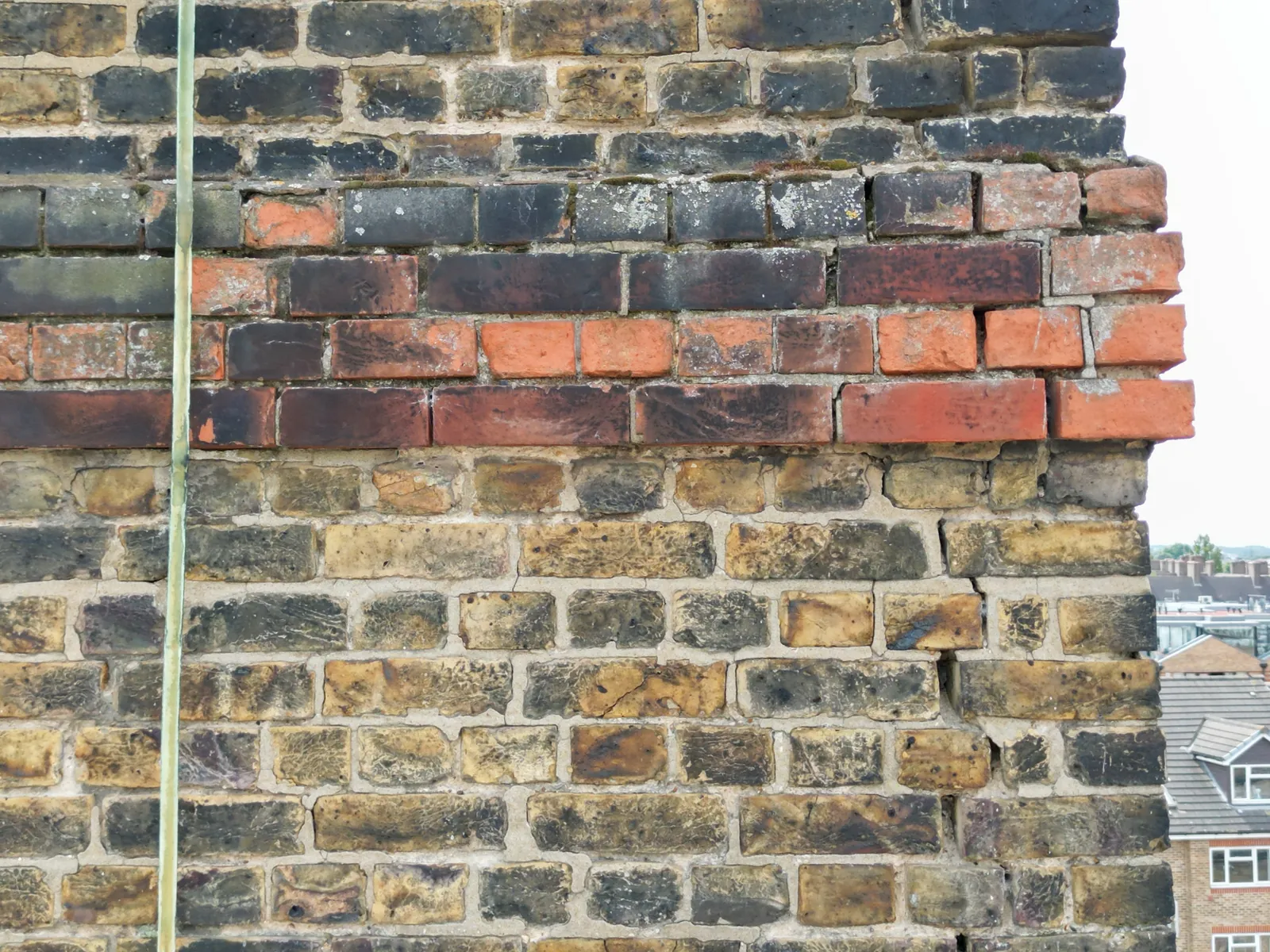
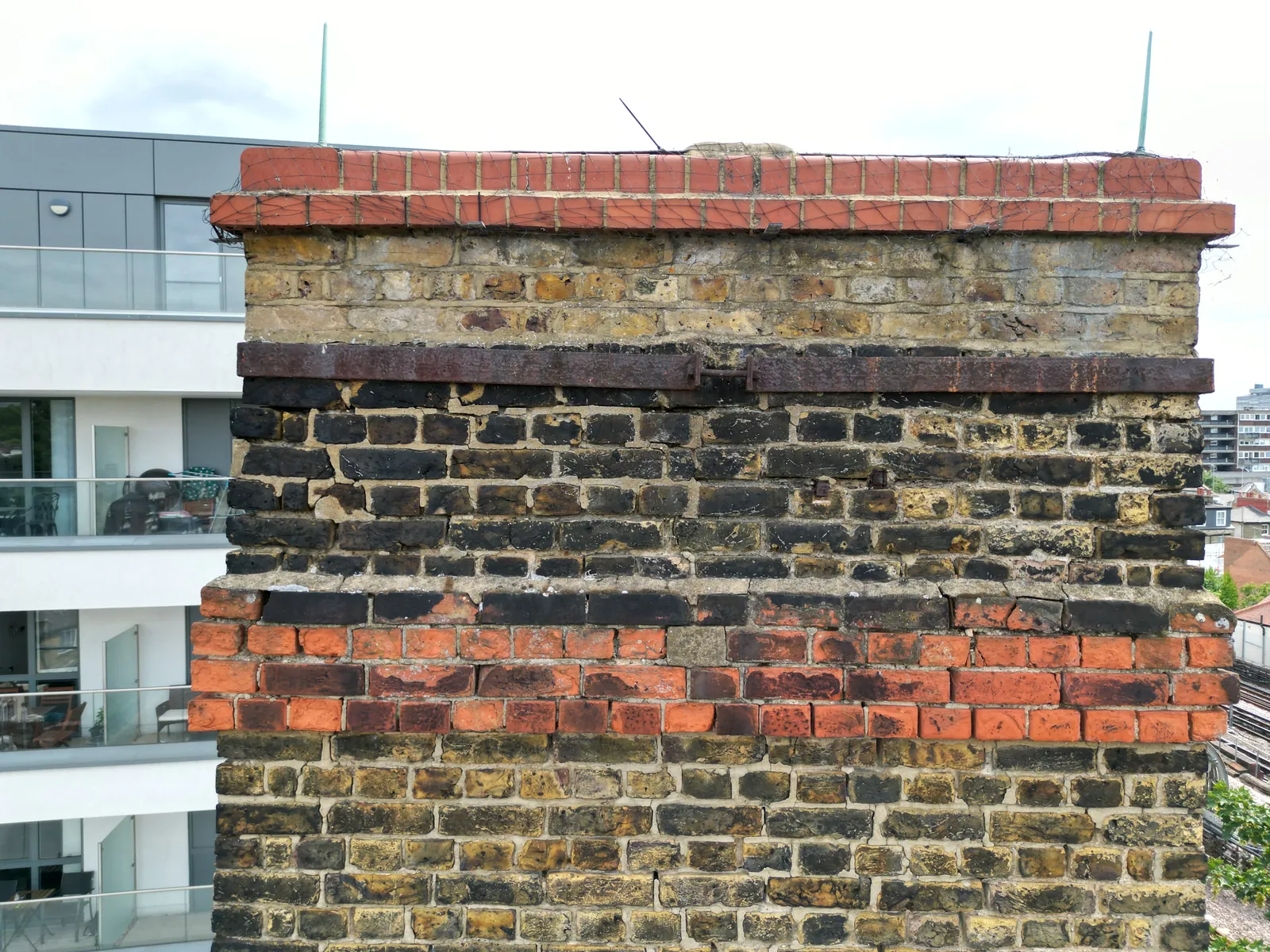
Example Image Quality
Click each image to view example image quality
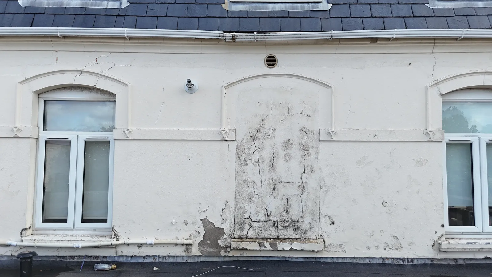
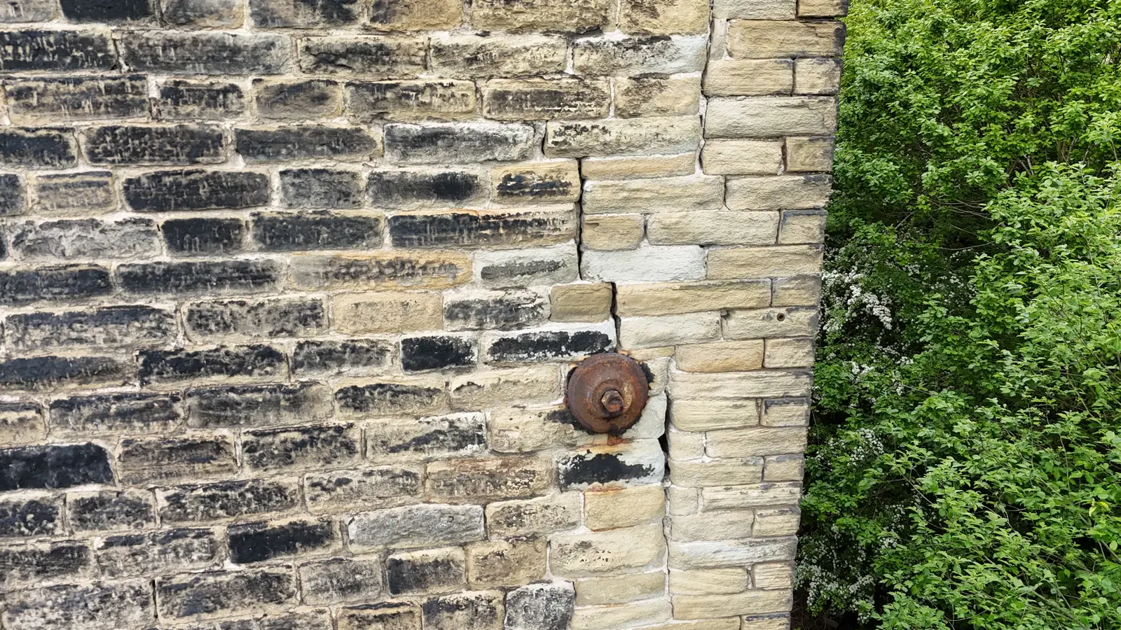
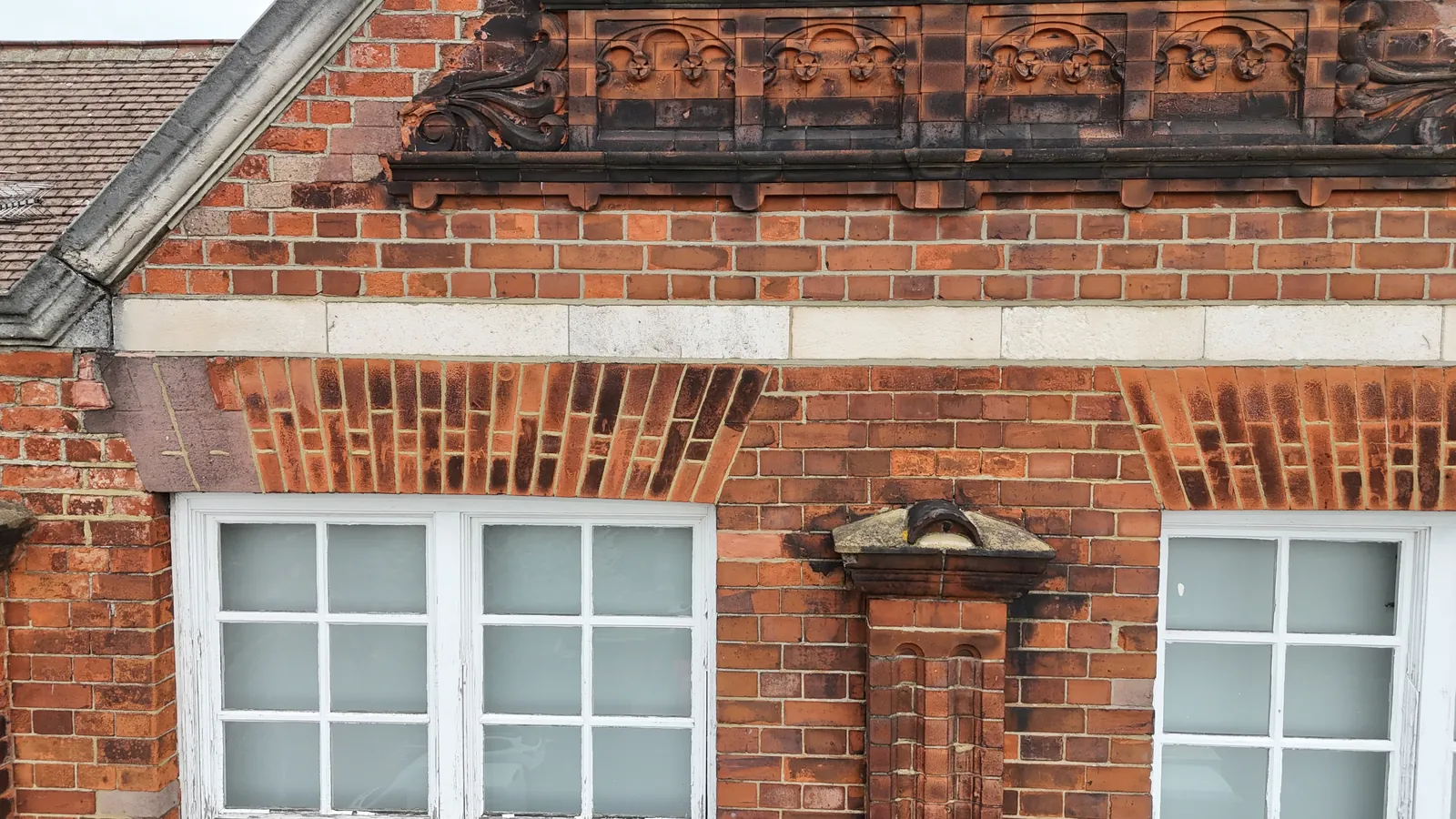
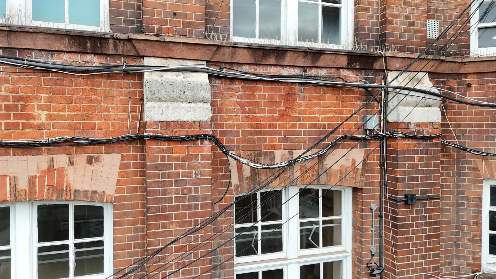
What Your Façade Survey Includes
Every façade survey is issued as a complete record of your building’s external envelope, ready to share with your surveyor, contractors or insurer.
| Deliverable | What it is | Included |
|---|---|---|
| 4K stills | High-resolution photographs of every elevation, capturing details that might be missed by the human eye. | Standard |
| Organised by elevation | Images sorted into colour-coded folders by elevation, so every defect can be located at a glance. | Standard |
| Survey paperwork | Your RAMS, airspace map and pre-flight documents, filed alongside the imagery. | Standard |
| Secure delivery | Your own folder on our client portal, with links you can share with your team and contractors. | Standard |
| Thermal imaging | Identifies issues such as water ingress, thermal bridging and insulation gaps that are not visible in standard images. | Optional |
| 3D models & offsite measurements | Detailed 3D models of the structure, so measurements can be taken offsite without a return visit. | Optional |
| 2D elevation drawings (DWG) | Measured elevation drawings produced from façade point clouds for design teams. | Optional |
| Written condition report | A written report highlighting visible defects and priorities, prepared by our qualified surveyors. | Optional |
Optional outputs are captured on the same site visit. Just let us know at quote stage and there is no need for a return visit.
At a Glance
Capture
4K stills & video
Access required
Usually none
Imagery issued
Within 48 hours
Thermal imaging
Optional
Scaffold needed
None
Coverage
Mainland UK
Get a Quote
Send us an address. We will come back the same working day with a price and a scope.
What Does a Façade Survey Cover?
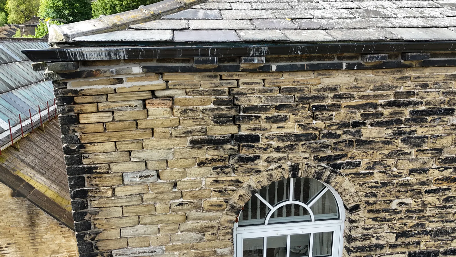
The drone systematically scans every part of the façade and external envelope, including areas that are difficult, costly or dangerous to reach. A typical survey covers:
- Brickwork & pointing
- Render
- Cladding panels
- Curtain walling
- Lintels & window surrounds
- Parapets & copings
- Gable ends
- Gutters & downpipes
- Fascias & soffits
- Chimneys & flashings
Thermal imaging can also identify water infiltration, thermal bridging and insulation gaps that are not visible to the naked eye.
The result?
A complete, detailed view of every elevation, with comprehensive reporting and no one working at height.
Why drones
Safer, faster and less disruptive
Surveying building façades often involves people working at height, which carries its own inherent risks. Drones eliminate this hazard, keeping inspectors safely on the ground while the drone completes the hazardous parts of the survey.
Drones also cover large areas swiftly, which means less downtime and lower costs than scaffolding or rope access, both of which need considerable time to set up and take down.
Using drones for façade inspections means improved safety, higher quality data, reduced disruption, less time on site and comprehensive reporting.
CAA
CAA Operational Authorisation 11363
Fully insured, with £10m public liability and specialist UAV cover
The benefits
Why use a drone for façade inspections?
Compared with scaffolding, MEWPs or rope access, a drone survey delivers better data with far less time, cost and disruption.
- Improved safety. Inspectors stay safely on the ground while the drone completes the hazardous parts of the survey.
- Higher quality data. High-resolution imaging captures intricate details that might be missed by the human eye, and thermal imaging reveals issues not visible in standard images.
- Faster surveys. Drones cover large areas swiftly, with no scaffolding or rope access to set up and take down.
- Reduced disruption. Unlike scaffolding or MEWPs, a drone survey has negligible impact on building occupants or passers-by.
- Preventive maintenance. Regular surveys detect defects early, so small issues are addressed before they become substantial, costly damage.
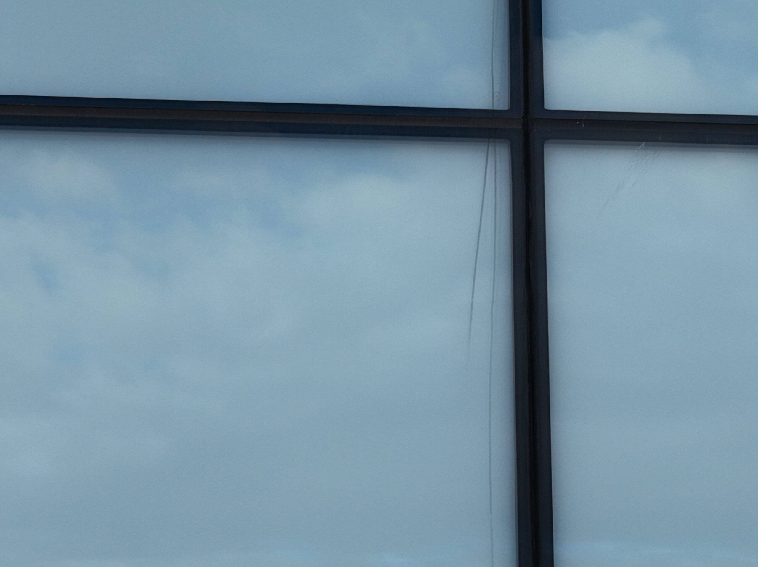
Glazing, cladding and panel joints captured without obstructing views or disturbing occupants.
Sectors We Cover
Façade surveys across every sector
From commercial offices and residential blocks to heritage buildings and public-sector estates, we survey façades of every size and type.
Our service is suitable for
- ›Offices and commercial premises
- ›Warehouses, factories and industrial buildings
- ›Retail units, shopping centres and retail parks
- ›Residential apartment blocks and housing developments
- ›Housing association and social housing properties
- ›Schools, colleges, universities and education estates
- ›Hospitals, clinics and other healthcare buildings
- ›Local authority and public-sector buildings
- ›Historic, heritage and listed buildings
- ›Hotels, leisure centres and hospitality properties
- ›Care homes and assisted-living facilities
- ›Distribution centres and logistics hubs
- ›Churches and places of worship
- ›Agricultural and rural buildings
- ›MOD, defence and secure estate buildings
- ›Prisons and custodial facilities
- ›Construction sites and newly completed developments
- ›Multi-site commercial and residential property portfolios
For clients with assets spread over large areas, we build a consistent visual library of the external envelope of every asset, helping teams compare condition and prioritise maintenance.
Why choose us
Why choose Drone Site Surveys?
A successful façade survey starts with capturing the right detail. At Drone Site Surveys, we understand that building surveyors and asset managers need more than attractive aerial photographs. They need clear, comprehensive imagery that helps them understand the condition of a building’s external envelope.
Our experienced drone pilots take a methodical approach to façade inspections, capturing everything from overall elevations to close-up details of brickwork, cladding, glazing, joints and structural features. By combining specialist inspection experience with high-resolution drone technology, we provide the visual evidence needed to identify potential defects, investigate areas of concern and support informed maintenance and repair decisions.
Clients choose Drone Site Surveys for our specialist experience, professional standards and independent approach:




How it works
Our drone façade survey process
From first enquiry to secure delivery, every survey follows the same six steps, so you always know what happens next and when.
Tell us about the building
Email us the site address with postcode, the elevations you need surveyed and what you need from the survey. We’ll come back with the options available.
Planning and quote
We carry out a desktop assessment of the property and the surrounding airspace, check the survey against current UK drone regulations, and prepare your quote. You receive it by email with no obligation, along with the airspace map for your site and an example delivery so you can see exactly what you’ll be getting.
Booking your date
Once you’re happy with the quote we add your job to the schedule and start monitoring the Met Office forecast. In the meantime we prepare the pre-flight paperwork, including our risk assessment and method statement (RAMS), which we can send over for your records. As soon as we have a clear weather window and pilot availability, we confirm your attendance date. You don’t normally need to be on site.
The survey
Our CAA approved pilot works systematically around the building, capturing every agreed elevation in high-resolution overlapping imagery, with thermal or 3D capture where specified.
Processing
Every image is checked and organised into colour-coded folders by elevation. Any thermal analysis, 3D models, measurements or reporting you’ve asked for are completed at this stage.
Delivery
We email you a link to our secure online portal, where your imagery, reports and any other agreed outputs are ready to view, download and share with your team or contractors. Alongside the deliverables you’ll find a folder containing the pre-flight paperwork, a copy of the drone airspace map for your site and any other relevant documents, so everything from the survey is in one place.
Request a Quote
Request a drone façade survey quote
Whether you need a condition survey, a thermal investigation or measured elevations, we can tailor the survey to your building and your requirements.
Send us the site address and a brief description of what you need, and we will come back with clear pricing and deliverable options.
Prefer to Speak to Us?
If you’d rather speak to one of the team, that’s no problem. Simply call the number below and one of our team will be more than happy to help.
Get a Quote
In The Know
Frequently Asked
Questions
Answers to the questions we are asked most often about drone façade surveys. If yours is not covered here, give us a call.
What is a drone façade survey?
A drone façade survey is a high-level inspection of a building’s external envelope carried out using drones equipped with high-resolution cameras. The drone scans every part of the façade, capturing photographs and video that give a complete and detailed view of the building, without anyone working at height.
Can a façade survey find water infiltration or insulation problems?
Yes, drones can identify potential issues such as cracked glazing, degraded seals and frame gaps. Findings are best confirmed with targeted checks on site.
Can you take measurements from a façade survey?
Yes. We can create 3D models of the structure from the drone imagery collected, which gives a comprehensive understanding of the building’s condition and allows measurements to be taken off-site. Measured 2D elevation drawings can also be produced from the data collected.
Is a drone survey quicker than scaffolding or rope access?
In most cases, yes. Drones cover large areas swiftly, and there is no scaffolding or rope access to set up and take down. That means less time on site, less downtime and lower costs.
Will the survey disrupt building occupants?
Very little. Unlike scaffolding or MEWPs, which can obstruct views and cause inconvenience, a drone survey can be completed with negligible impact on building occupants or passers-by.
What does a façade survey look for?
Cracking, spalling, loose or missing elements, failed joints and sealant, corroded fixings, damaged cladding panels and staining that suggests water is getting in. Findings are captured close up and organised by elevation.
Can you survey façades in city centres?
Yes. We check the airspace, arrange any permissions needed and agree a plan for public areas around the building, such as timings and any potential cordons required, before we fly.