


CAD & Revit drawings
Accurate floor plans, elevations, sections and Revit models produced using detailed building survey data captured through drones, laser scanning and 3D surveying technology.
Available Files: DWG, DXF, RVT, IFC & PDF
2D
CAD Drawings
3D
Revit & BIM Models
LOD
100 to 400
0
Days of Scaffold
Measured Building Drawings
Many buildings have no reliable drawings, or drawings that no longer match what was built. We capture the building with drones, laser scanners and 3D cameras, then draw it up to your specification.
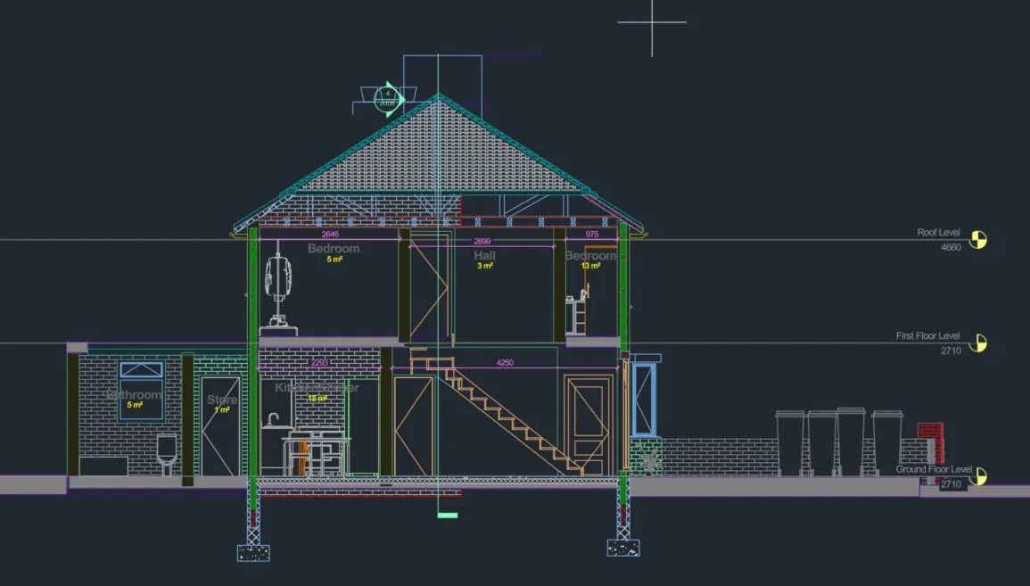
You can choose 2D CAD drawings (floor plans, elevations, cross sections and roof plans) or Revit and BIM models at the level of detail you need, from simple massing at LOD 100 to detailed models at LOD 400.
Everything is drawn from measured data, so your design team can start from an accurate as-built record.
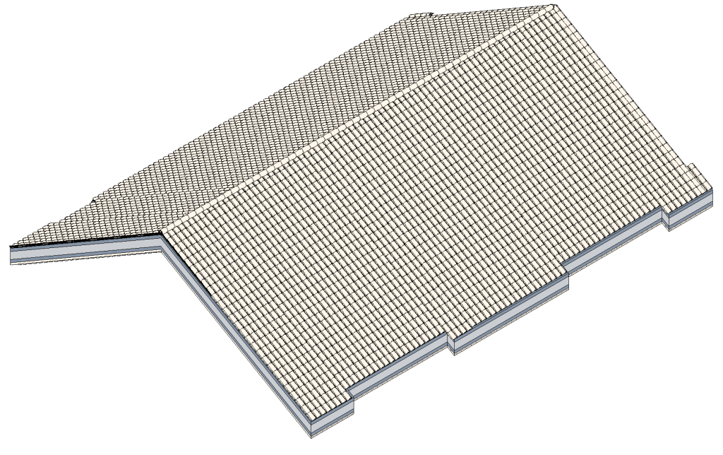
Example Image Quality
Click each image to view example image quality
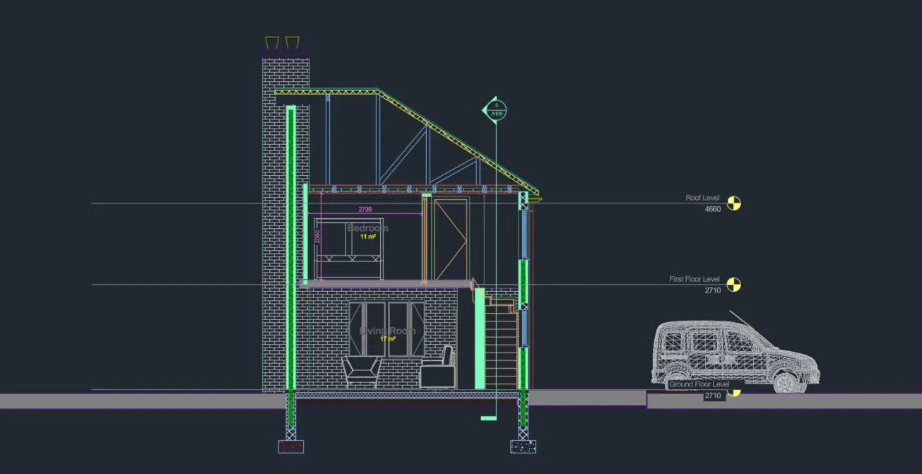
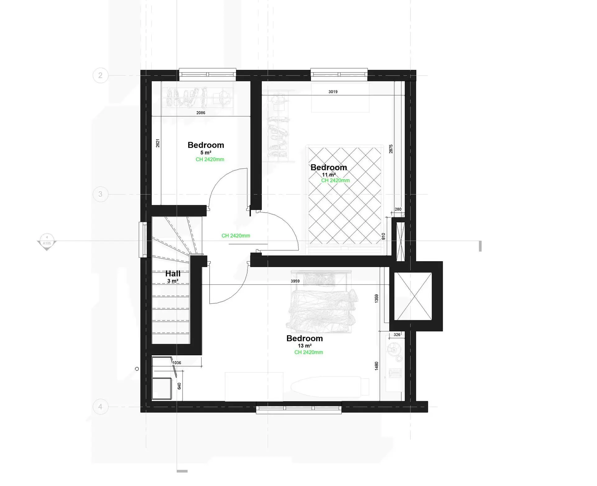
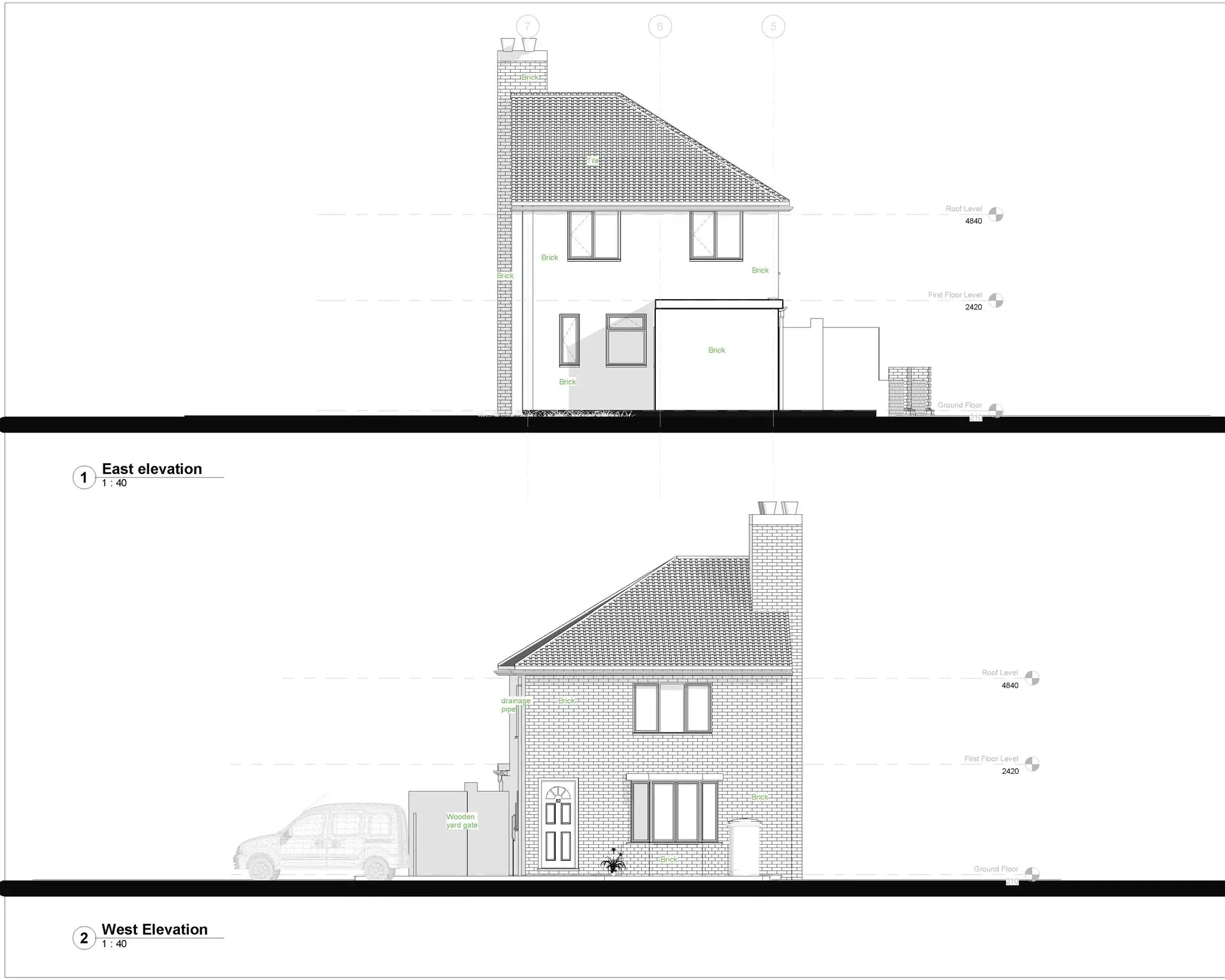
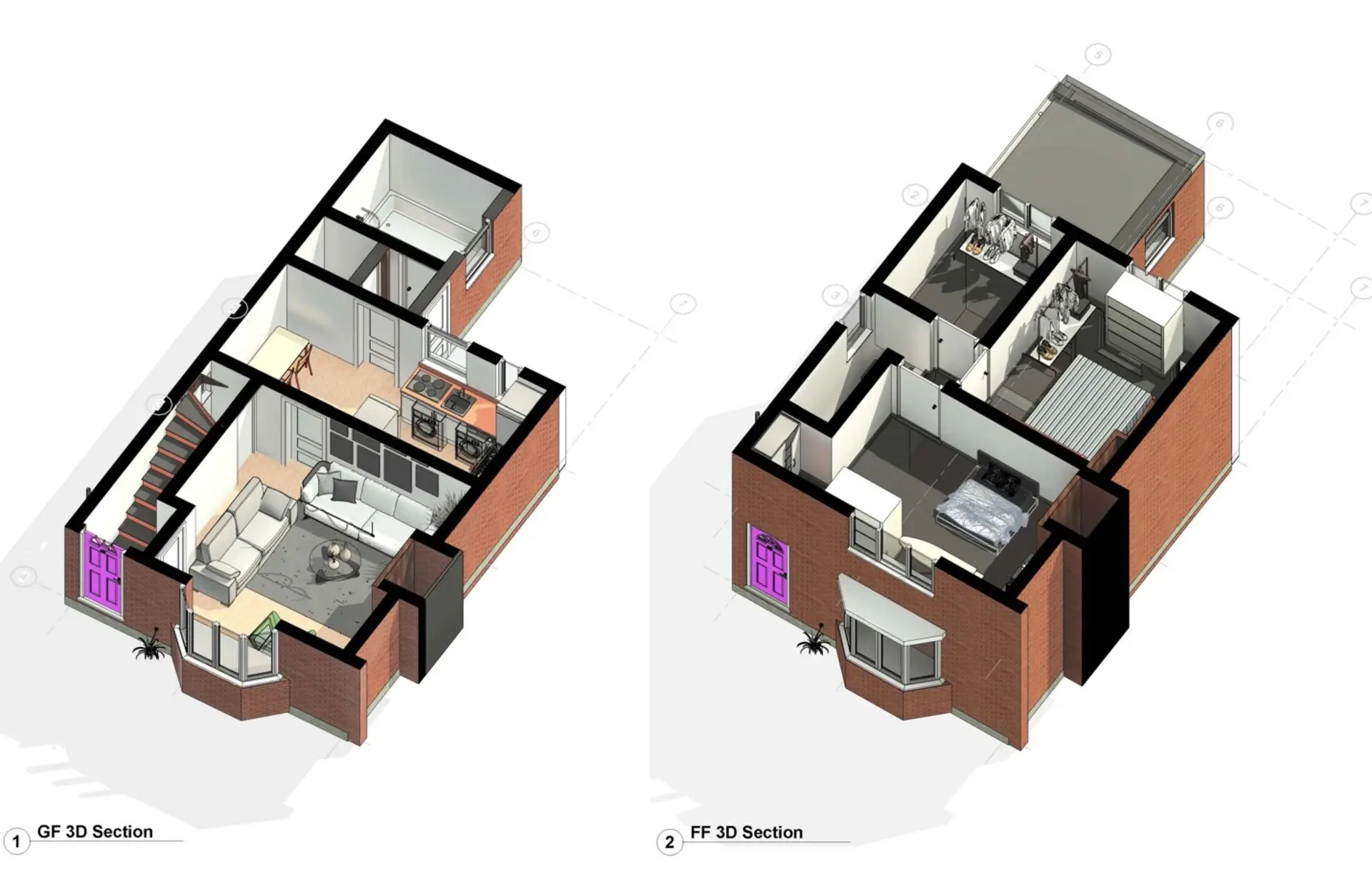
What Your Drawing Package Can Include
Choose the drawings and model detail you need. Every deliverable is drawn from measured survey data.
| Deliverable | What it is | Included |
|---|---|---|
| Floor plans | Measured 2D plans of every floor. | Standard |
| Elevations | Accurate drawings of every external elevation. | Standard |
| Roof plans | Roof layout and features, captured by drone. | Standard |
| Sections | Cross-sections through the building where needed. | Optional |
| Revit model | A 3D BIM model at the agreed level of detail. | Optional |
| Point cloud | The registered scan data in E57, RCP or LAS. | Optional |
| Area schedules | Floor areas measured to your standard. | Optional |
We agree the drawing scale, layers and level of detail with you before capture, so deliverables match your templates.
At a Glance
Capture
Drone + LiDAR scan
Access required
Internal & external
Pilot network
Nationwide
Revit / BIM
Available
Scaffold needed
None
Coverage
Mainland UK
Get a Quote
Send us an address. We will come back the same working day with a price and a scope.
Why Clients Choose Our Measured Drawings
Accurate drawings save time and mistakes later in a project. Clients benefit from:
Knowing the condition of your whole portfolio lets you mitigate risk, prioritise spending and act on real evidence rather than assumptions.
The result?
Accurate as-built drawings and models, ready for design, planning and facilities management.
Level of detail
LOD 100 to LOD 400
Level of Detail (LOD) sets how much information a model contains. LOD 100 is simple massing, LOD 200 adds general shapes and openings, LOD 300 gives accurate geometry, and LOD 400 includes detailed components.
We agree the LOD with you before capture, so you get the right level of detail for your project without paying for more than you need.
Drawn from measured data, not guesswork.
CAA
CAA Operational Authorisation 11363
Fully insured, with £10m public liability and specialist UAV cover
Why drones
Why use drones and scanning for measured drawings?
Measuring a building by hand is slow, and high-level areas like roofs and parapets are hard to reach. Drones and scanners capture everything accurately, including areas you can’t safely get to.
- No one at height. Roofs and high-level features captured by drone.
- Accurate. Drawn from laser scan and drone data.
- Complete. Inside and out captured in one survey.
- Flexible. From 2D CAD plans to detailed Revit models.
- Ready to use. Delivered to your standards and templates.
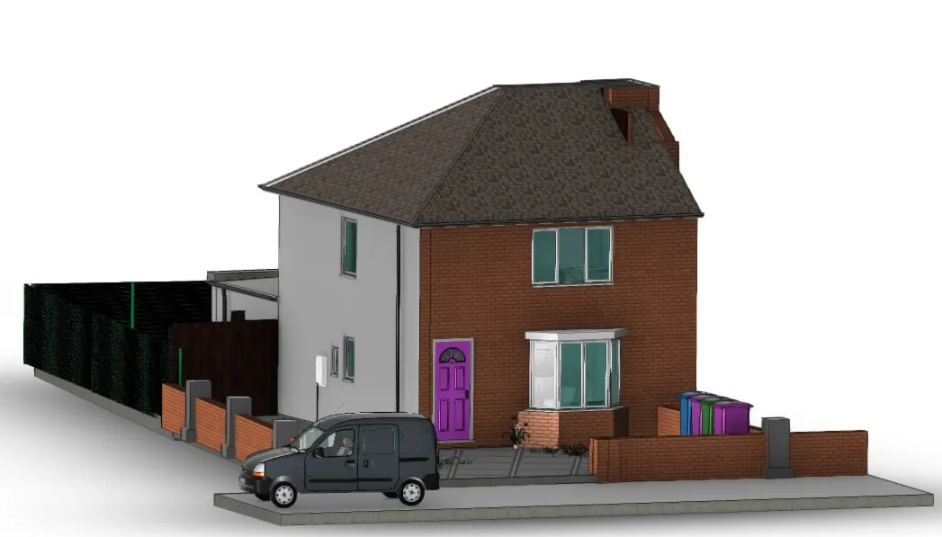
Measured Revit Models
Plans, elevations and models drawn from accurate survey data.
Who we work with
Drawings for architects, engineers and estates teams
We work with architects, engineers, surveyors, contractors and estates teams who need accurate drawings of existing buildings.
Our service is suitable for
- ›Architects
- ›Structural and building services engineers
- ›Building surveyors
- ›Contractors and developers
- ›Facilities and estates managers
- ›Housing associations
- ›Schools and universities
- ›Healthcare estates
- ›Heritage and listed buildings
- ›Commercial landlords
For estates with many buildings, we can build a consistent library of drawings and models across your portfolio.
Why choose us
Why choose Drone Site Surveys?
Accurate CAD drawings start with accurate survey data. At Drone Site Surveys, we do more than capture aerial imagery. We combine specialist drone surveying, terrestrial LiDAR, GNSS ground control and advanced photogrammetry to collect the detailed spatial information needed to produce reliable, measurable drawings of buildings, structures and land.
Our experienced survey teams work closely with our in-house CAD and BIM specialists, ensuring the right data is captured from the outset. This joined-up approach allows us to produce detailed floor plans, roof plans, elevations, sections and site drawings in AutoCAD DWG format, tailored to the requirements of architects, engineers, building surveyors and property professionals.
From initial site capture to finished CAD drawings, we manage the entire process in-house, providing a consistent, coordinated service with a clear understanding of accuracy requirements, drawing specifications and intended use.
Need accurate CAD drawings without the complexity of managing multiple survey providers? Speak to our team about turning drone and laser survey data into practical, design-ready drawings for your next project.
Clients choose Drone Site Surveys for our specialist experience, professional standards and independent approach:
We specialise in professional survey data capture and the production of accurate CAD drawings, rather than architectural design or construction services. Our detailed drone imagery, photogrammetry and laser scanning data provide the visual and spatial information needed to produce reliable, impartial as-built drawings that accurately represent existing buildings, structures and site conditions. This gives architects, engineers, surveyors and property professionals a dependable foundation for design, refurbishment, redevelopment and informed project decisions.




How it works
Our measured drawing process
From first enquiry to secure delivery, every survey follows the same six steps, so you always know what happens next and when.
Tell us about the property
Tell us about the building and the drawings or model you need, including the level of detail. We’ll recommend the right capture method.
Planning and quote
We carry out a desktop assessment of the property and the surrounding airspace, check the survey against current UK drone regulations, and prepare your quote. You receive it by email with no obligation, along with the airspace map for your site and an example delivery so you can see exactly what you’ll be getting.
Booking your date
Once you’re happy with the quote we add your job to the schedule and start monitoring the Met Office forecast. In the meantime we prepare the pre-flight paperwork, including our risk assessment and method statement (RAMS), which we can send over for your records. As soon as we have a clear weather window and pilot availability, we confirm your attendance date. You don’t normally need to be on site.
The survey
We capture the outside by drone and the inside with laser and 3D scanning, building a complete, measured record of the building.
Processing
The data is registered into a point cloud, then drawn up in CAD or modelled in Revit to the agreed level of detail.
Delivery
We email you a link to our secure online portal, where your imagery, reports and any other agreed outputs are ready to view, download and share with your team or contractors. Alongside the deliverables you’ll find a folder containing the pre-flight paperwork, a copy of the drone airspace map for your site and any other relevant documents, so everything from the survey is in one place.
Request a Quote
Request a Revit & CAD drawings quote
Whether it’s a single floor plan or a full Revit model of a large building, we can tailor the survey to your brief.
Send us the address and a brief description of what you need, and we will come back with clear pricing and deliverable options.
Prefer to Speak to Us?
If you’d rather speak to one of the team, that’s no problem. Simply call the number below and one of our team will be more than happy to help.
Get a Quote
In The Know
Frequently Asked
Questions
Answers to the questions we are asked most often about CAD drawings and Revit models. If yours is not covered here, give us a call.
What drawings can you produce?
Floor plans, elevations, cross sections and roof plans in AutoCAD at the level of detail you require.
What is LOD?
Level of Detail. It sets how much information a model contains, from simple massing at LOD 100 to detailed components at LOD 400.
What file formats do you supply?
DWG, DXF, RVT, IFC and PDF for drawings and models, with point clouds in E57, RCP or LAS if you need them.
How do you capture the building?
Drones for the outside and roof, and laser or 3D scanning inside, merged into one measured point cloud.
Can you work to our CAD standards?
Yes. Send us your templates, layers and scale, and we’ll draw to them.
Do you need access inside the building?
YES, for internal plans and sections. We’ll agree timings to keep disruption to a minimum. If you just require the external envelopes and roof of the building, NO access is required